Tuesday, August 25, 2015

Hiking Mt. Si: Lose the Crowds on the Talus Loop

If you're seeking solitude in nature, heading to Mt. Si in the Mountains to Sound Greenway (Interstate 90 corridor) east of Seattle can be risky business on a weekend day. Often the parking lot is full and overflowing, and you'll be hiking with a steady stream of humanity (and canines). Si draws up to 50,000 visitors a year, making it the most heavily used trail in the state.


Still, Mt. Si is heavily used for good reason, with a well-maintained trail grinding up 4 miles of switchbacks over 3,700 feet in elevation gain through often lush forest.

On a hazy Sunday, the air is thick with smoke from forest fires throughout the region hovering in the valleys like a gauzy gray curtain. Itching for a hike, I reason that being in the woods would be safer for my lungs. At the last minute and on impulse I head to Mt. Si, where I haven't been for about 8 years.

When I arrive a little before 8 a.m. on Sunday morning, the parking lot is less than a third full. Perhaps the smoke is keeping people away? 

A beauty of the otherwise nasty smoke is how it filters the sunlight. As I start up the trail, the sun through the smoke and trees back-lights the forest in a golden-pinkish glow.


And surprisingly, I don't encounter that many other hikers as I head upward. The trail winds through primarily second-growth forest, with few openings in the trees for views. It's mostly Douglas fir and hemlock, with an understory of sword ferns, vine maples, and other native plants and shrubs.


By the time I reach the upper junction to the 1.3-mile Talus Loop trail, I know I can't make the summit and get home in time. What the heck, I decide, and take the cut-off.

Immediately the trail becomes narrower and obviously less traveled, and, if you have a touch of the romantic like me, feels a bit enchanted. (Of course, given the right conditions, like a misty day, I'd say any trail through a forest is enchanting.)


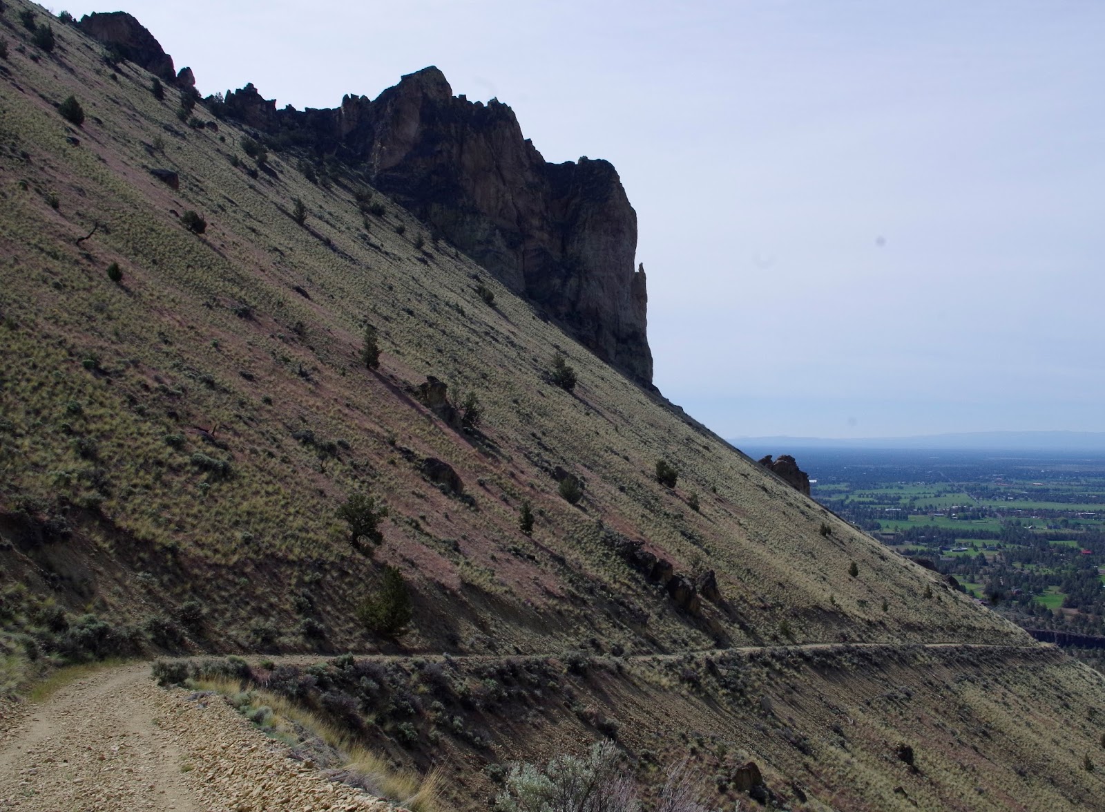
After losing elevation and heading away from the main trail eastward for about 10 minutes or so, I reach the open talus slide portion of the loop.  


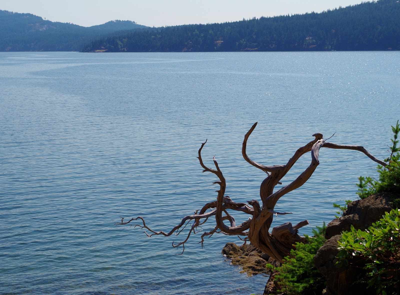
This massive rockslide opens up an impressive panorama on an otherwise heavily forested trail. Today the views are muted and obscured by smoke.


The stretch of trail across the talus is only about...50 yards?

After pausing to take pictures at the talus field, I continue down the trail into increasingly lush vegetation. A trail runner dashes past me like a gazelle leaping down the trail. He's the only other person I see during my 30 minutes or so on the loop trail.


I almost miss the switchback that loops back to the main Si trail.  The trail appears to continue, and when I stop to take a picture, I happen to glance to my right and notice the switchback, which is more well-worn. Pay attention!

Just below the bottom edge of the talus slide, the trail passes an especially verdant area rich with moss and ferns. In this drought year, it's a very welcome sight.


Maidenhair fern
As I'm tramping happily through the forest, enjoying the solitude and beautiful scenery, suddenly I feel a familiar sharp pain on the back side of my bare upper arm and let out a loud, high-pitched yelp. Quickly I spin around, arms flailing, and see the yellow jacket that stung me. Ouch! 

Then I'm running down the trail as fast as I can because those angry little suckers can sting more than once. Within 100 yards, I've reached the main trail.


Needless to say, I trot down the rest of the trail quickly, with my arm swelling and sore. Lots more hikers are coming up the trail as I'm descending. 

Despite the stinging finale, I quite enjoyed the talus loop trail. It's a nice variation if you're short on time or want an easier hike than the slog to the top of Si. According to the Washington Trails Association website, it's a 3.7-mile roundtrip from the main trailhead via the Talus Loop Trail, with an elevation gain of 1,750 feet.


Happy trails and thanks for visiting Pacific Northwest Seasons!

In between blog posts, visit Pacific NW Seasons on FaceBook, Twitter, and Instagram for more Northwest photos and outdoors news. 


When You Go
Here is a link to a map and directions to the Mt. Si trailhead from Seattle. It's about 30 miles east, just off I-90 in North Bend, Washington. I highly recommend getting there by 8 a.m. or earlier on summer/fall/nice weather weekends, although many people start later. The Talus Loop junction is well-marked at both the lower and upper juctions, just to the right off the main trail. A Washington State Parks Discover Pass is required for parking at the trailhead (although there are free parking days a few times a year for day-use; the remaining dates for 2015 are August 25, September 26, and November 11).


Tuesday, August 18, 2015

Orcas Island Respite: Going with the Flow

Do you feel like your life is overscheduled, overplanned, and entirely too busy? Not enough time in the day to get it all done?

Big kudos to you if you don't, but I (and seems like most of my peers) feel that way. Consider that sociologists write about the importance of doing nothing for our health, creativity, and well-being. 

Usually when I go to the San Juan Islands, I tend to run around seeing as many friends as possible, kayaking, hiking, and generally packing a lot into my visit. I enjoy it all; I love seeing friends and being active outdoors. But sometimes I need to force myself to slow down.


I just spent three days on Orcas Island, and yes I saw friends and went hiking. But I also didn't make plans for much of my time there. And you know what I realized?

It's something I need to do more often.


My friends/family will tell you I'm one of the busiest people they know. So this was a departure for me. I mostly just let things happen. And of course Orcas is a wonderful place to just let it happen and watch the world around you.

The relaxation started on the ferry ride over, which was perfectly timed to coincide with the setting sun on a warm summer evening.


When I awoke the next day, I did have plans to meet a friend for morning tea. But beyond that, nothing else planned for 24 whole hours. (Next trip that will stretch.)

Afternoon time I found a quiet spot on the East Sound shoreline and stayed put for several hours, with camera, sketch pads, pencils, book, and sit pad. 


Because I think it's such a Zen, in-the-moment-and-paying-attention thing to do, I pulled out my sketch pad to capture some nearby trees on pencil and paper.  

Madrona and western red cedar trees

And that night I lay outside on my back for a while, joined by a young buck deer, and gazed up at the inky dark, starry sky for the annual Perseid meteor shower. I say summer isn't complete without seeing at least one shooting star. About 15 meteors streaked across the sky in fast-fading traces of white while I watched; perhaps I missed a few when I blinked.

Next morning I drove out to Doe Bay Cafe for an excellent breakfast with local friends, who then took me on an invigorating 5-hour hike through the woods at Moran State Park.


Buckwheat crepes stuffed with house-made ricotta and local fruit, Doe Bay Cafe

So we got a little off track and added a mile, it was foggy at the only viewpoint, and it rained a bit. These weren't really annoyances, just part of the experience of exploring this spectacular park's many miles of trails.

Cairns!

An early evening soak in the hot tubs overlooking the cove at Doe Bay was a perfect way to cap the day. 


After another exquisite breakfast at Doe Bay Cafe, which features mostly organic, grown onsite produce and eggs, a friend and I wander around, taking pictures and enjoying the magical, come-as-you-are vibe that this friendly, rustic resort exudes

Seaside yurt, Doe Bay Resort


Then it's a stop at an artist's studio (open house weekend) followed by the Saturday farmer's market in Eastsound, where artisan Carol Anderson recreates a favorite pair of earrings that I'd lost.

Check out Carol's beautiful pendant, which of course she made.

...Which feels like I'm starting to do a little too much. So I take a pass on visiting more artist studios, say my goodbyes, and head to a quiet beach to sit and sketch the next few hours until I leave to catch the ferry.

It's about the process, not accuracy, right?:)

Three days pass too quickly, as does most of life as we get on in years. But I leave a little more relaxed than I usually do. I pondered the life and death of loved ones this year, the future, the past, and generally tried to stay in the moment. (Tried ...)

How about you? Have you taken a break lately with nothing planned? How did that work for you?

Happy trails and thanks for visiting Pacific Northwest Seasons!

In between blog posts, visit Pacific NW Seasons on FaceBook, Twitter, and Instagram for more Northwest photos and outdoors news.    

When You Go

Here is the San Juan Islands ferry schedule from Anacortes, Washington. This time of year and on most weekends, a reservation is recommended. There are lots of places to stay in the islands, from camping to high end resorts. Here is a link to find places to stay in the islands.


Monday, August 10, 2015

Hiking Central Oregon: Smith Rock State Park Summit Loop Trail

My rock climber friends have raved about Smith Rock for years, but I didn't clue in until recently that it's also a fantastic place to hike. (I'm a failed rock climber who prefers my feet on solid ground...:)

Thanks to my friend Colleen for introducing me to the hiking trails there. Earlier this season we spent an excellent morning hiking through and around the enchanting and spectacular rock formations at Smith Rock State Park.

In geologically fascinating central Oregon, the Smith Rock complex is part of an ancient volcanic caldera that counts among the largest in the world. Things are quiet now (thankfully!), but over the millenia the Crooked River cut through layers of ancient rock and basalt flows, revealing the present dramatic rock formations known as Smith Rock tuff.


After parking (go early to get a spot) and stopping to take the requisite shots of the rock drama ahead, we drop down to the Crooked River, cross the wooden bridge, and head up the Wolf Tree Trail along the river, part of the relatively new Summit Loop Trail.

Within 10 minutes we've left the crowds behind, most of which are heading up the more popular Misery Trail.


In fact we have the trail to ourselves for the first several miles as we loop up along the river and then take the junction up the Burma Road Trail (an old fire road and now part of the Summit Loop Trail). 


Along the way, occasionally I catch the scents of pine and sage on this more arid, dry side of the Cascades. Of couse this year it's way too dry on either side of the mountains here in the Northwest. The Wolf Tree Trail to the Burma Road junction is the most forested part of the park.

Although it's not steep, the Burma Road Trail rises about 1,200 feet up from the river to the highest point, gradually. And the views just get more and more ahhh-some looking down to the rock formations and the volcanoes beyond.

Broken Top and the Three Sisters on the horizon.
Can you spot the wood bridge where we started?
 
Looking back at the gradual incline of the Burma Road Trail.
 

By now we've shed a layer and are down to tank tops and shorts.  Up here the trail meanders through shrub-steppe and then starts switchbacking downward and back towards the main rock formations.


Despite getting a tad lost because the trail junctions aren't well marked up here, we manage to find our way and loop back down to the river again, onto the River Trail.


Crooked River below, snowy Mt. Jefferson on the horizon.


When we return down to the river level, the trail is basically flat the few couple miles back to the bridge and parking area. So we enjoy the easy stroll and appreciate the solitude we had until getting to the River Trail.


After making a hairpin turn, the River Trail loops back, passing many climbing routes that draw climbers from all over the world.  Climbers in colorful helmets  clutter the basalt cliff faces, but we don't linger to watch.


By the time we finish after about 3 hours, the day is heating up and lots more people are here taking pictures and walking the trails. Time for a cold one over in nearby Terrebone.

After Hike Eats
After a short drive of not more than 10 minutes, we land a table on the deck at the Pump House in Terrebone. I split an order of the fish tacos, which hit the spot and were quite tasty. Two thumbs up.

Happy trails and thanks for visiting Pacific Northwest Seasons!

In between blog posts, visit Pacific NW Seasons on FaceBook, Twitter, and Instagram for more Northwest photos and outdoors news.    

When You Go

Here is a trail map of Smith Rock State Park. The Summit Loop Trail, which is about 7.5 miles overall, is shown as several connecting trails (Wolf Tree, Burma Road, Summit Trail, to River Trail). Entrance to the park is off Highway 97 in Terrebone, about 27 miles north of Bend, Oregon. Day use parking is $5, and walk-in camping is available on a first-come, first-served basis.


Sunday, August 2, 2015

Northwest Reflections: Time Out

Are you having a good summer? Getting out and exploring the great Northwest, or wherever you live?

I've been out hiking a lot this year, and you'll see more hike posts soon (with lots of photos, of course). But a recent family loss has kept me from the blog for a while.

When I got the email that my big brother David had collapsed while on his daily run, but was in the hospital, I didn't immediately understand the inevitable. What I've since learned is that 95 percent of those who suffer a sudden cardiac arrest don't survive. Unfortunately my brother was one of the 95 percent.

This sudden and unexpected, premature loss was an awful shock. An older sibling is someone you've never experienced life without. Of course his two daughters and wife are experiencing this new huge hole in our lives even more intensely.

Sure when we were kids my brother was a brat sometimes (I'm sure it went both ways) and he didn't often pay attention to this little sister who always sought his favor. As someone offering me condolences so aptly said, "Brothers offer such a distinct combination of love and irritation."  

Me and big brother, many moons ago.
 
But as a man, my brother was sweet, gentle, funny, very intelligent, and kind, beloved by those he managed in his high tech career and, well, pretty much everyone who knew him. As a former employee of his said, "He offered a warm, steady hand and humanism in a chaotic and often sterile working environment."

For me, with both our parents gone, he was my center of gravity, even from afar. 

Born in Seattle and raised in Portland/Seattle, we were the most athletically inclined and active of our five siblings. He backpacked in the Olympic Mountains with his wife, went on field trips around the region for his Geology degree from the University of Washington, was a runner most of his life, and together we bicycled the 200 miles from Seattle to Portland one year for the annual STP


Sister, me, and brother, birdwatching at Deception Pass.

Alas, he skipped town and settled in San Francisco with his family. I joked that he was a geographically desirable sibling.

Now that I'm back in Seattle, it's easy to forget that he's not just hundreds of miles to the south. Instead of California, now he lives forever in our hearts.

So hug your siblings, your kids, your friends, your family, and let them know how important they are to you. Because you just never know what lies ahead.

Anyway, just wanted you to know I'll be back!

Happy trails and thanks for visiting Pacific Northwest Seasons.

And remember, every moment is precious.